The Delaware Water Gap, nestled between the borders of New Jersey and Pennsylvania, is a hidden gem with tranquil landscapes, striking scenery, and 40 miles of glistening waters.
The Delaware Water Gap has invited tourists for centuries to explore the natural wonders in the region. It is the ideal weekend getaway destination, where you can enjoy some of the best hiking trails in the East Coast. It is known for its hiking trails and many other outdoor adventure options, like kayaking across the Delaware River, watersports, and more!
Continue reading this blog to know more about the best spots in Delaware Water Gap for hiking.
Delaware Water Gap: A Hiker’s Paradise
Hiking in Delaware is a unique experience; the hiking trails of the region offer the best views of the alluring landscapes. The Delaware Water Gap National Recreation Area offers more than 150 miles of trails with different difficulty levels; it is truly a hiker’s paradise!
Apart from the best hiking in Delaware Water Gap, the area is also known for its waterfalls.
Plan Your Hiking Adventure in The Delaware Water Gap
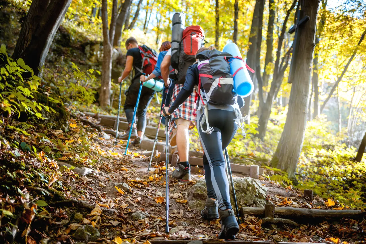
Whether you are an experienced hiker or a beginner, you must always be prepared for anything. If you are new to The Delaware Water Gap, here are some tips that might help you get a better idea of the trails.
- The Delaware Water Gap has trails for every level; from beginner trails to advanced trails, your options are endless.
- To ensure your safety, there are certain safety rules to abide by.
- Make sure you pick the right trail. If you are planning for a hike with a large group, make sure the trail you choose is comfortable for all the members.
- To hike across Delaware Water Gap may not be as easy as it sounds; certain trails have a high elevation and rocky terrain.
- There are plenty of trail maps and visitors centers available around Delaware Water Gap
- Weather changes are very spontaneous in the region, so it is best you always keep track of the weather.
Preparations and Safety Measures For Hiking in Delaware Water Gap
There are safety rules one must follow while hiking in the Delaware Water Gap. Here are some tips for preparation that you can follow to have a safe hiking adventure.
Essential Gear and Equipment Required:
- Navigation: Maps, compass and GPS system
- Sun Protection: Sunglasses, sunscreen, hat
- Insulation (during winters): jacket, gloves, rain guards, and thermals
- Illumination: flashlights, headlamps, etc.
- First Aid Kit
- Repair Kit and Tools: knife, screwdriver, scissors, etc.
Water and Food:
- Water is arguably the most important thing you need to carry when hiking, especially in hot weather.
- Some trails may have reliable water sources, but it is always better to be on the safer side.
Other Equipment:
- Proper shoes for walking
- Bug spray
- Locator beacon (some areas may not have service)
- Backpack with good support
Family-Friendly and Beginner Trails in Delaware Water Gap
A family hike can be super fun and thrilling for everyone, especially for kids. Here are some of the kid-friendly hiking trails Delaware Water Gap has to offer:
1. Hackers Falls and Cliff Trail Loop
Located in the Delaware Water Gap Recreation Area, it is a 3-mile loop trail. It is one of the best hikes in Delaware Water Gap and is very popular among hikers. The hike takes about an hour and a half to complete and is relatively an easy hike. The best time to visit this trail is April-October.
2. Raymondskill Falls Loop Trail
Compared to the other Delaware State Park trails, this trail is one of the shortest. It is only 0.5 miles long, super beginner-friendly. It takes only 16 minutes to complete, and you will encounter waterfalls and wildflowers too. The best time to visit this trail is April-October. It is one of the easiest places to hike in Delaware Water Gap
3. Mount Minsi Via Appalachian Trail
The Appalachian Trail is a very popular hiking trail; people visit from all over the country to hike here! The Mount Minsi Trail is a moderately challenging trail about 4.7 miles long. It is a popular place for bird watching. This trail is dog-friendly as well, but your pet must stay on the leash.
Overnight Backpacking Adventures in Delaware Water Gap
Planning a multi-day hike? Delaware Water Gap has some great trails perfect for overnight camping. In this section, I’ll be covering all that you need to know about overnight hiking at Delaware Water Gap, campgrounds to camp in, etc.
Permits and Rules to Follow While Camping Overnight
In the Delaware Water Gap Recreation Area, overnight camping is permitted only on the Appalachian National Scenic Trail. Camping is restricted to thru-hikers who are hiking for more than two days in a row. Camping is allowed only for one night, and only ten people per campsite are allowed. Fires, charcoal stoves, and grills are strictly prohibited. Only self-contained stoves are allowed. If you have a vehicle, there is a parking facility available so long as you fill out the overnight parking log.
Campgrounds, Tent Sites
Apart from places to hike in Delaware Water Gap, they also have 78 tent and trailer sites. Check out the different sites below for camping in the Delaware Water Gap.
- Dingmans Campground
- Mohican Outdoor Center
- Worthington State Forest Campground
To know more about these campgrounds, check out the government website of Delaware Water Gap.
Safety precautions while camping overnight
- Hike with a full moon: You will have better visibility and won’t have to rely much on your headlamp.
- Do not camp alone: Hiking at night can be intimidating, even more on your own. Especially if you are new to hiking, it is better if you are with someone.
- Prepare to encounter wildlife: research wildlife in the region you are planning your hike in and pick your trail accordingly. You will most probably encounter wildlife at night at most hiking trails.
- Pack Layers: Nights are always cold, especially in Delaware Water Gap; the weather is constantly fluctuating, so it is recommended that you carry layers of clothing.
Staycation Before your Hiking Adventure
Before embarking upon your adventures along the Delaware walking trails, enjoy a staycation and take in the local charm of Delaware Water Gap.
A good rest and a slight exploration of the region can strengthen your hike.
HolidayKeepers has some great vacation home options all around the poconos for you to relax and revel in before your adventures.
Wrap Up
Choose from the various trails mentioned above and embark upon your hiking adventures! The Delaware Water Gap truly has some of the best views and natural landscapes, and hiking in the region is the best way to enjoy the outdoors!
Begin planning your hiking adventure now!
Contact HolidayKeepers for all your accommodation needs; you will be treated with the utmost care, and your booking process will be easier than ever!
FAQs
Q: Which trails in Delaware Water Gap are pet-friendly?
A: Crater Lake Loop Trail, Coventry Pond Trail
Q: How far is the Delaware Water Gap from New York City?
A: Delaware Water Gap is just a 1-hour, 20-minute drive from NYC
Q: How many hiking trails are there in the Delaware Water Gap Recreation Area?
A: There are over 150 miles of trials in the Recreation Area, off various difficulty levels.